October 2025
TO: County of Calaveras
FROM: Tom Infusino, Facilitator, Calaveras Planning Coalition
RE: Amendments to the Open Space Plan
DATE: October 8, 2025
I. Recommendations
A. Review these proposed amendments to the Open Space Plan for this year.
B. Include these amendments when you update the Open Space Plan to conform to the requirements of SB 1425: Government Code Section 65565.5.
C. In 2026 and 2027 work on amendments to the Open Space Plan to timely comply with AB 1889 and AB 2684, to meet the requirements of the Housing Accountability Act, and address CEQA exemptions.
II. Background
Historically the Government Code has required a general plan to include an open space plan that addresses the use of open space for the preservation of natural resources (e.g. wildlife habitat and rivers), the production of resources (e.g. food, fiber, and minerals), outdoor recreation, public safety (e.g. flood safety and wildfire safety), and the protection of cultural resources (e.g. Native American cultural sites). The 2019 Calaveras County General Plan Updated includes and Open Space and Conservation Element that addresses these traditional open space issues in coordination with other general plan elements.
Since adoption of the 2019 Calaveras County General Plan Update, California has added new requirements regarding the open space and conservation elements of a general plan.
Senate Bill 1425 (Stern, 2022) added Section 65565.5 to the Government Code on September 30, 2022. This law requires all cities and counties to review and update the open space element of their general plans by January 1, 2026, to address three specific topics:
- Equitable access to open space for all residents, correlated with the environmental justice (EJ) element
- Climate resilience and other co-benefits of open space, correlated with the safety element
- Rewilding opportunities, as defined, correlated with the land use element
Assembly Bill 1889 (Friedman, 2024), also known as the “Room to Roam Act” amended Section 65302 of the Government Code to require cities and counties to review and update the conservation element of their general plans in the next adoption or revision of one or more elements on or after January 1, 2028, to:
- identify and analyze connectivity areas, permeability, and natural landscape areas within the jurisdiction;
- identify and analyze existing or planned wildlife passage featuresto ensure that planned development does not undermine their effectiveness;
- consider the impacts of development and the barriers caused by development to wildlife and habitat connectivity;
- avoid, minimize, or mitigate impacts and barriers to wildlife movement to the extent feasible; and
- analyze and consider opportunities to remediate existing barriers to wildlife connectivity and restore degraded habitat and open space.
Finally, AB 2684 (2024) requires the safety element to address extreme heat hazards upon the next update of one or more elements on or after January 1, 2028.
We understand that during this first step of the process, the County is working to meet the requirements of SB 1425 by the end of the year. We are aware of the County’s desire to quickly make as few policy changes to the general plan as possible to meet new and existing open space plan requirements.
We believe that the County can meet the deadline of SB 1425, and also include some general plan amendments to meet at least some of the requirements of AB 1889. Much of this work can be completed efficiently by modifying and adding introductory text to better identify the content of existing open space plan, to better explain the functioning of its parts, and to better clarify its implementation. Because this would not make additional substantive changes to policies or implementation measures, it would not trigger additional CEQA review, and therefore is feasible to do in the next few months. What these improvements would do is help our local land owners to better compete against landowners from other counties for the state’s open space conservation funding. The quality of the local open space plan is an important factor in those funding competitions.
Below we make our recommendations to amend the general plan. We provide the portion of the general plan or supporting document to be changed, the change we recommend, and a footnote to explain the need for the change. We hope that the Planning Department and the Planning Commission will consider these recommendations.
In step two of this process, the County will need to make substantive amendments to policies and implementation measures in the open space plan to meet the terms of AB 1889 and AB 2684 by January 1, 2028. That may trigger amendments to the general plan environmental review documents. At that time, we encourage the County to also make additional substantive improvements to the open space plan to address provisions that have been weakened by the Housing Crisis Act, the Housing Accountability Act and by amendments to CEQA.
Understand that we believe the County can and should do much more. Climate change poses serious threats to open space resources in Calaveras County. Climate change adversely impacts the habitats for fish, game, and special status wildlife species. Climate change threatens the productivity of farm lands, range lands, and timber lands. Climate change degrades recreational experiences. Climate change increases the already high and very high risks of wildfire across the developed and undeveloped landscape. In addition, Calaveras County has a vast landscape suitable for the carbon sequestration needed to restore the world’s climate and to sustain the prosperity of California industries relying on the cap-and-trade program. For these reasons, we encourage the Planning Department, the Planning Commission and the Board of Supervisors to move beyond minimal compliance with the new open space plan requirements. In the footnotes below we note some opportunities to do so. We are available to meet with Planning Department staff and individual Planning Commissioners at your convenience to discuss these matters in more detail.
Proposed Amendments to Update the Open Space Plan
Below we identify the page of the current general plan provisions, the text of the current provisions, and the changes we propose to the provisions. In footnotes we explain the rationale for each change.
- Changes to Conservation & Open Space Element
Page – COS 1:
Other general plan elements addressing conservation and open space-related issues are:
- Public Facilities and Services Element: Land accommodating floodwater and for groundwater recharge; Areas required for groundwater basin recharge; Water supply
- Resource Production Element: Land and water reclamation; Location, quantity and quality of the rock, sand, and gravel resources; Areas containing mineral deposits, including those in short supply; Land used for the managed production of resources, including forest lands, rangeland, agricultural lands and areas of economic importance for the production of food or fiber
- Safety Element: Open areas for public health and safety; soil conservation (e.g., protecting soil productivity through erosion prevention, control, and correction); Land accommodating floodwater for stormwater management
- Land Use Element: Open space lands classified as Resource Management (pubic and quasi-public land), and lands classified as Resource Production (agriculture and timberland) as shown on the Land Use Map; Goals, policies and implementation programs intending to maintain open space, conserve and promote effective use of natural resources, and preserve the rural character of the county through encouraging clustering, infill, and designing new development to conserve natural, scenic, and cultural resources
Addition:
- “Circulation Element: Network of pedestrian and cycling paths for recreation.
- “Community Planning Element: Resource protection, resource production and recreation.
“A list of the specific goals, policies, implementation measures and objectives that comprise the open space plan are provided in Table COS-1.” [1]
Page – COS 1
Background and Setting, Associated Plans and Documents
Addition:
“Vision and Guiding Principles
“The general plan’s vision and guiding and principles influence the County’s approaches to open space conservation.
“The County’s vision states,
‘The historical character of the county’s communities, the value of its productive resources, the distinction of its physical beauty, and growing economic opportunities will create a high quality of life for residents and a remarkable and memorable experience for visitors to the county.’
“This vision acknowledges the importance of open space values including historical character, resource production, and the physical beauty of the landscape.
“Calaveras County covers approximately 663,000 acres of land and water. Approximately 519,000 acres are privately owned. The vast majority of this land is a network of open space used for resource production, resource conservation, and recreation. (See Land Use Designation Map and Table LU-1; Technical Background Report, Figure 18 Calaveras County Open Space Inventory.) Thus, the general plan guiding principles emphasize the leadership role that private property owners and residents play in open space management, and the supporting role played by government agencies.
‘Maintenance of open space, wildlife habitat, agricultural lands and forests will be accomplished by the continued ability to maintain the productive resources in the county by those who own, operate, or manage them.
‘County government will respect and protect the property rights of people in their efforts to maintain or develop productive resources.
‘Community Plans, as developed by the local residents, will help preserve the character of historic communities.
‘The County understands that its economy relies heavily on agriculture, forestry, mineral industries, recreation, and tourism, and desires to support those endeavors where practical.’
“As a result, the open space plan focusses on creating a broad spectrum of opportunities to allow private land owners to manage their open space lands as they wish. Thus, some private land may remain open space in the long-term simply by the ongoing profitable management of timber, farming, grazing and mining operations. Other lands will remain open space in the long-term through supplemental revenues from agricultural tourism, energy production, and/or carbon sequestration. Other lands will remain open space in the long-term with the help of private conservation initiatives and government programs. Meanwhile, the County supports these efforts by planning for the integrated conservation of these diverse private open space lands in conjunction with large blocks of public lands and waterways across the vast landscape. The County also assists land owners as they participate in new economic endeavors and government conservation programs. Only in limited circumstances, usually associated with the conversion of open space to other uses, are open space values preserved by local government regulations.”
“Because of the dispersed nature of Calaveras County’s 22 unincorporated communities, connectivity and coordination are key guiding principle when it comes to planning for open space resources.
‘Roads and streets will be well-maintained and well-connected and other modes of transportation will be encouraged.
‘The General Plan promotes coordination among agencies to provide effective and efficient water, wastewater disposal, fire protection, and other essential services.
Through service connectivity and inter-government coordination the County helps to maintain and protect a vast network of open space lands. [2]
Page – COS 2
Surface Water
Calaveras County topography varies from about 200 feet above sea level in the western County to 8,100± feet in the mountainous eastern county resulting in highly variable average levels of precipitation (20 inches per year in the west and 60 inches annually in the northeast) which comes in the form of both snow and rain generally between October and May.
Addition:
“Climate change is altering traditional precipitation amounts and patterns. Studies depict that precipitation is generally trending downward. In addition, the decline in the snowpack reduces its seasonal surface water storage capacity. The larger variability in storms alters flood intensity and frequency. These factors in turn trigger the need for additional water storage and distribution facilities, improved water use efficiency, upgraded flood controls, and the conservation of aquatic and riparian habitats. At the same time, the hotter climate increases the water needs of plants and animals, including livestock and crops.
“The County employs many general plan provisions to address surface water management for climate change resilience. The County cooperates with water agencies in protecting local surface water rights. (Policies PF 2.6, PF 2.9, Implementation PF-2K.) Through Integrated Regional Water Management Planning, Calaveras County works with water agencies and other stakeholders to plan for the water management needs associated with climate change. (See Policy COS 2.1, Implementations COS-2A, COS-2D, COS-3D, PF-2F, PF-2G.) During the review and approval of new discretionary development proposals, the County makes efforts to ensure the new development will have a sustainable water supply. (See Polices PF 2.1, PF 2.7 to 2.10, Implementations PF-1B, PF-2B, PF-2C, PF-2D.) The County encourages water conservation and recycling. (Policy PF 2.2, PF-2H, PF-2I.) By stretching these surface water supplies for developed land uses, the County helps to ensure that future open space land uses dependent on the county-wide network of streams, springs and recharged groundwater supplies will have sufficient water to remain productive. (See Technical Background Report, Figure 20 Water – Major Rivers and Drainages, Figure 13 Agriculture – Distribution of Williamson Act Lands, Figure 14 Timber – Distribution of TPZ lands.
The County also protects the wildlife habitat values of its waterways. The County employs development setbacks to protect riparian and aquatic habitats. (See Policy COS 2.2, Implementation COS-3C.) The County intends to complete a Habitat Conservation Plan for special status amphibian species. (See Implementation COS-4C.) The County applies mitigation protocols for impacts to wetlands and riparian corridors when completing the environmental reviews of project applications. (See Policy COS-3.3, Implementation COS-4L, COS-4N.)
“The County employs some general plan provisions to address flooding. When reviewing some applications for new discretionary development the County assess and remediates unreasonable risks of harm from flooding and dam failure. (See Safety Element Policy S 2.1, S 2.2, S 2.4; Implementation S-2A and S-2D.) The County has identified substandard culverts along likely evacuation routes, and hopes to develop a program to replace these. (Safety Element Policies S 2.2 and S 2.3; Implementation, S-2E.) The County intends to update stormwater run-off standards and hopes to find funding to prepare a stormwater management strategy to address regional flood management needs. (Safety Element Policy 2.3, Implementations S-2B and S-2C.)” [3]
Page – COS 3
Groundwater
Addition:
“Because climate change reduces precipitation, it reduces the rate of recharge of groundwater resources subject to recharge. In addition, since climate change reduces rain and snow amounts, streams flows tend to decline earlier in the dry season. This in turn limits the amount of water that feeds shallow gravel deposits and springs fed by these streams. These shallow gravel deposits and springs are key sources of water for some grazing operations in Calaveras County.
“The general plan includes many provisions to address groundwater management for climate change resilience. The County participates in regional efforts to address groundwater management challenges in the face of climate change. Through Integrated Regional Water Management Planning, Calaveras County works with water agencies and other stakeholders to plan for the water management needs associated with climate change. (See Policy COS-2.1, Implementations COS-2A, COS-2D and COS-3D.) In addition, the County works with stakeholders on a groundwater management plan for the Eastern San Joaquin Groundwater Basin. (See Policies PF 2.6, PF 2.7, Implementation PF-2L.) The County continues groundwater monitoring efforts. (See Policies PF-2.6, PF-2.7, ImplementationPF-2M. Also, the County carefully scrutinizes additional demands on existing groundwater resource associated with new residential development. (See Policy PF 2.8, PF-2D.) Finally, the County intends to adopt review standards for new discretionary development applications to ensure that they do not compromise groundwater recharge. PF 2.4, Implementation PF-2J.)” [4]
Page – COS 3
Associated Plans and Documents
Additions:
RMC, November 2006. Mokelumne/Amador/Calaveras Integrated Regional Water Management Plan (M/A/C IRWMP). The study is available at both CCWD and online through the Upper Mokelumne River Watershed Authority at: http://www.umrwa.org/
Woodard & Curran, November 2018, Mokelumne/Amador/Calaveras Integrated Regional Water Management Plan Update (M/A/C IRWMP Update). The study is available online through the Upper Mokelumne River Watershed Authority at: http://www.umrwa.org/
RMC, June 2015, The Mokelumne Watershed Interregional Sustainability Evaluation (MokeWISE). The study is available online through the Upper Mokelumne River Watershed Authority at: : http://www.umrwa.org/ [5]
Page COS-5
Vegetation
Additions:
“Climate change affects vegetation patterns on the landscape. With reduced precipitation comes shifts in the boundaries of vegetation types on the land. Plants and trees adapted to drier conditions slowly spread up in elevation. Oak woodlands give way to oak savannas. Mixed conifers give way to oak woodlands. Red fir give way to mixed conifers. At the highest elevations, white bark pines just die off and give way to granite.
“As this process continues at a fast pace, dead plants and trees build up on the landscape. These fuel loads occur in concert with hotter and drier conditions and higher winds associated with climate change. Together these factors combine to create increased wildfire fire hazards in areas already categorized as having high or very high wildfire risks.
“Each subsection of Calaveras County has its own wildfire challenges.
“On opens space lands, private and public land managers are clearing fuel breaks and using livestock to graze range lands. On public and private forest lands managers are thinning forests, reducing fuel loads, and completing prescribed burns.
“Because open space wildfires can spread to developed lands, local businesses and residents must also respond to these increased wildfire risks. Some able residents are redoubling their exhausting and expensive efforts to maintain defensible space, to harden structures against wildfire, and to prepare for emergency evacuation. Nevertheless, there remains great need to assist others who are unable to take on these tasks without assistance. In addition, the increased risks of wildfire have led private fire insurance companies to no longer offer coverage in many parts of Calaveras County. Residents and businesses are increasingly relying on California Fair Plan to provide fire coverage, and paying much more for insurance.
“The Conservation and Open Space Element is correlated with the Safety Element to improve wildfire safety for climate change resilience.
“First, the general plan addresses County efforts to reduce wildfire risks and to respond to wildfires in open space areas. The County supports maintaining healthy forests and oak woodlands across the landscape through fuel reduction projects. (See Policies COS 1.1 and COS 1.2, Implementations COS-2A through COS-2F) The County implements the Local Hazard Mitigation Plan, the Emergency Operating Plan, and the Tuolumne – Calaveras Unit Strategic Fire Plan in concert with CalFire, the U.S. Forest Service and other agencies to stay prepared for, and to respond to, wildfire emergencies. (See Safety Element, Page S-2, S-4, S-5, S-6.) This integrated network of mutual assistance provides wildfire safety across the landscape despite the challenges of climate change. (See Technical Background Report, Figure 42 Safety – Federal Responsibility Area, Figure 43 Safety – CALFIRE Battalions & Stations; Figure 44 Safety – Local Fire District Boundaries.)
“Second, the general plan addresses County efforts to assist current residents to prepare for and respond to wildfires that threaten their homes and businesses. The County provides information on fire safe building techniques, defensible space, and fire-safe communities to assist residents. (Safety Element Implementation S-1F, S-3O.) The County assess the fire safety of affordable housing and seeks funding to rehabilitate that housing to remediate fire safety deficiencies. (Safety Element Implementation S-3P.) The County seeks funding for land owners seeking to remove dead trees. (Safety Element Implementation S-3Q.) The Calaveras County Council of Governments has completed an emergency evacuation preparedness plan, and the County hopes to adopt the plan’s integrated network of evacuation routes and implement that plan over time. (See Safety Element Implementation S-1C, S-3G, S-3V.)
“Finally, the County carefully reviews applications for new discretionary development and, when necessary, includes conditions to provide for fire safety. (See Safety Element, Policies 3.1 to 3.5, 3.9; Implementations S-3A, S-3B, S-3C, S-3D, S-3E, S-3I, S-3L, S-3O, S-3Q, S-3S, S-3W.)” [6]
Page COS-5
Species
Additions:
“As noted under the discussion of vegetation above, the boundaries of vegetation types are changing as a result of climate change. In addition, climate change is altering the timing of migration as habitat blocks dry up earlier in the season. The cumulative impacts of other wildlife habitat degradation and climate change present serious challenges to the local survival of sensitive species. A key tool in relieving some of this stress on habitat connectivity is to plan open space conservation to provide blocks of suitable wildlife habitat and corridors connecting those blocks to facilitate wildlife migration.
“The Conservation and Open Space Element includes some provisions to address wildlife habitat connectivity. The County will require safe wildlife passage for new discretionary developments on wildlife corridors. (See Policies COS 3.4, COS 3.9; Implementations COS-4E, COS-4O.) The County has adopted zoning code provisions that require setbacks for new development from riparian corridors and wetlands to implement the general plan. (See Policies COS 3.2, COS 3.3, and COS 3.6; Implementations COS-4L, COS-4N.) The County reviews applications for discretionary development for impacts to special status species, sensitive habitats, and oak woodlands and requires mitigation for potentially significant impacts. (See Implementations COS-4D, COS-4H, COS-4I.) The County hopes to someday establish written guidelines listing mitigation options for impacts to biological resources, and to complete a natural communities conservation plan for amphibians. (See Implementations COS-4B, COS-4C.)”
“In addition, the general plan provides some opportunities for rewilding degraded wildlife habitat. Rewilding may happen in the context of surface mine reclamation that may leave behind wildlife habitat including new lakes and landscaped hills. (See Policy RP 5.1, Implementation RP-4H.) Rewilding may also happen in the context of wildfire recovery plans. (See Policy S 3.7, Implementations S-3J, S-3K.)” [7]
Page COS-6
Air Quality/Greenhouse Gases
Additions:
“The Conservation Element includes provisions for inventorying local GHG emissions, for preparing a plan to reduce those emissions in the long-erm, and for reducing GHG emissions pending completion of the plan. (See Policy COS 4.4, Implementations COS-5B, COS-5C, COS-5M.) The County has completed the emissions inventory and a draft plan for both reducing GHG emissions and sequestering carbon on open space lands. The County hopes to use federal funding and state cap-and -trade revenues to hire local businesses to implement many of the provisions of the GHG reduction plan. These provisions call for installing water and energy conservation devices, converting from fossil fuels to green electricity, and reducing forest fuels.
These provisions also call for establishing a carbon sequestration program on resource production lands. In turn, carbon sequestration will provide additional revenue for resource production operations and thereby help them to continue to conserve open space. Thus, by implementing the GHG reduction plan, the County will help to diversify our local economy and to strengthen our efforts to fight climate change using our open space lands. This is just one of the many ways we are using open space lands to improve climate change resilience in Calaveras County.” [8]
Page COS-7
Scenic Resources
Addition:
“The State of California granted Wild and Scenic designation to 37 miles of the Mokelumne River in 2018.”
Add study to references:
“California Natural Resources Agency, Mokelumne River Wild and Scenic River Study Report, 2018.”
Page COS-8
Recreation Resources
Addition:
The open space plan includes many policies and implementation measures to provide for outdoor recreation. Provisions in the Circulation Element call for the creation of an integrated network pedestrian and bicycle paths. (C-5, C 5.1, C 5.2, C-1A, C-5A.) Provisions of the Resource Production Element recognizes that agricultural lands, forest lands and mineral resource lands can be conserved and managed for multiple beneficial uses including recreation. (RP 1.5, RP 2.3, RP-5, RP 5.1, RP 5.3, RP-2C.) The Conservation and Open Space Element includes provisions to maintain the quality of recreational waters, to preserve scenic resources, to develop recreational facilities, and to protect cultural resources. (COS-1, COS 2.2, COS-6, COS 6.1, COS 6.2, COS 6.3, COS 6.4, COS 6.5, COS 6.6, COS-3D, COS-5M, COS-7A through COS-7I.)
“Recreational resources are equitably available throughout Calaveras County. Just access to the higher elevation forestlands in the easternmost reaches of the county is managed by the United States Forest Service. (See Resource Management designation on the Land Use Map, Table LU-1, and Table LU-2.) There people have free or inexpensive access to thousands of acres of these forestlands for hiking, swimming, picnicking, fishing, hunting, rock climbing, cross-country skiing, snowshoeing, and other outdoor recreational activities. Additional free access to tens of thousands of acres for forest recreation is generously provided on private lands owned by Sierra Pacific Industries. (See Technical Background Report, Figure 14 Timber – Distribution of TPZ land in Calaveras County.)
Just access to recreation is provided at federally managed facilities in other parts of the county as well. Inexpensive outdoor recreational opportunities can be found in the western part of the county at New Hogan Reservoir on the Calaveras River near Valley Springs and in the southern part of the county at New Melones Reservoir on the Stanislaus River. In addition, reasonably priced outdoor recreation in the northwestern part of the county is provided at Comanche Reservoir on the Mokelumne River where just access is managed by the East Bay Municipal Utility District. (See Technical Background Report, Figure 31 Recreation – Recreation Resources.)
In many community centers, free outdoor recreational facilities are available in local parks and in conjunction with schools. (Many local community plans call for the careful management of existing parks, the addition of new parks, and for bicycle and pedestrian paths for outdoor recreation. (CPC 3.1, CPC 5.4, CPC 5.5, CPC 5.6, CPG-2.1, CPF 2.2, CPG 2.3, CPMH 1.1, CPMH 3.1, CPMR 1.6, CPPA 1.1, CPPA 1.3, CPRF 1.2, CPRF 2.1, CPRC 2.1, CPSA 2.1, CPSA 4.1, CPSR 2.1, CPVS 1.2, CPVS 1.11, CPVS 1.3, CPVS 3.4, CPVS 4.1, CPVS 4.2, CPVW 1.5.)
Page COS-9
Cultural Resources
Addition:
“The open space plan includes policies and implementation measures to protect cultural resources that might be otherwise be harmed by discretionary development. (COS 7.1, COS 7.2, COS 7.3, COS-8A through COS 8-H.)”
New Section:
“Open Space Plan Implementation
“An open space plan needs an action component that identifies how the County achieves its goals by following the numerous open space policies and performing the many implementation measures.
“A review of the County’s annual general plan implementation report indicates that there are two kinds of general plan implementation measures. On the one hand, County planning staff members perform many of the implementation measures in the open space plan on an ongoing basis during the discretionary review of proposed projects. On the other hand, many implementation measures await the County’s approval of new County Code provisions, or the creation, staffing and funding of new programs. “Table COS-2 provides the County’s tentative schedule for implementing these measures. The table is flexible, allowing the County to move measures earlier to take advantages of funding opportunities or later to recognize staff and funding limitations without formal general plan amendments. The table does not create a cause of action against the county for any failure to timely implement any measure by any date. The County remains dedicated to implementing the open space plan.
Additional Tables:
Table COS-2: Calendar for Open Space Plan Implementation 2025
Topic Measure
From 2026 to 2027: Biological Resources & Objective Housing Standards
Convert to Objective Housing Standards
Mitigation Options for Biological Resources COS-4B
Wildlife Corridors COS-4E
Riparian Corridors (Ordinance) COS-4N
Grading, Drainage, and Erosion Control COS-3B, S-4B
Project Specific Run-off Management Standards S-2B
Begin HCP/NCCP Process COS-4C
From 2028 to 2029: Agricultural Resource Production
Innovative Techniques (Clustering Standards) LU-2E
Min. Parcel Sizes Adjacent to RP Lands RP-1A
Solar Use Easement on Ag. Land RP-2A
Right to Farm Ordinance RP-2B
Williamson Act Implementation RP-2C
Protect Groundwater Recharge Areas PF-2J
From 2030 to 2031: Fire Safety
Air Quality Regulations – Prescribed Burns COS-2C
Post-Fire Assessment and Rehabilitation S-3J
Fuel Management New Development S-3S
Visitor High Occupancy Uses (fire safety) S-3R
Evacuation Routes, Sites and Centers S-3V
Level of Service Thresholds PF-1A
Woody Biomass COS-5L
Green Waste Collection COS-5D
From 2032 to 2033: Mining Resources
Amend County Code (Mining) RP-1A, 1B
Mineral Resource Information RP-4C
Mining Advisory Committee RP-4D
Water Impacts from Mining RP-4F
From 2034 to 2035: Recreation and Scenic Resources
Bicycle and Pedestrian Plan C-4D
Hillside and Hilltop Construction Standards COS-6B
Recreation Facilities COS-7A
Bicycle and Pedestrian Facilities COS-7B
Parks and Recreation Funding COS-7I
Local and Regional Trail System COS-7E
From 2036-2037: Native American Cultural Resources
Identify Native American Resource Sensitive Areas COS-8A
Professional Qualifications/Cultural Resources COS-8C
Subsurface/Unanticipated Cultural Resources COS-8D
Treatment of Archaeological Resources COS-8F
From 2038-2039
Complete implementation for any measure listed above that remain incomplete.
Table COS-1: General Plan Provisions in the Open Space Plan
|
Statutory Requirements for an Open Space Plan in Calaveras County |
General Plan Text and Graphics in the Calaveras County Open Space Plan |
|
Resource Preservation: including, but not limited to, areas required for the preservation of plant and animal life, including habitat for fish and wildlife species; areas required for ecologic and other scientific study purposes; rivers, streams, beaches, lakeshores, banks of rivers and streams, and watershed lands. |
Vision, Principles, Table LU-1, Land Use Map, Table LU-2, LU-2, LU-4, LU 4.1, LU 4.4, LU 4.10, LU-2E, LU-4B, C-1B, H-1.4, RP 1.5, RP-2, RP 2.3, RP-3, RP 3.1, RP 3.3, RP 3.4, RP 4.3, RP 4.4, RP-5, RP 5.1, RP 5.3, RP-1C, RP-1D, RP-1E, RP-1F, RP-2C, RP-2D, RP-2F, RP-2G, RP-3B, RP-4E, RP-4F, RP-4H, COS-1, COS 1.2, COS 1.3, COS-2, COS 2.1, COS 2.2, COS-3, COS 3.1, COS 3.2, COS 3.3, COS 3.4, COS 3.5, COS 3.6, COS 3.7, COS 3.8, COS 3.9, COS-4A, COS-4B, COS 4.1, COS 4.2, COS 4.3, COS 4.4, COS 4.5, COS 4.6, COS 4.7, COS 4.8, COS 4.9, COS 5.1, COS 5.2, COS 5.3, COS 6.5, COS 6.6, COS-1A, COS-2A, COS-2B, COS-2C, COS-2D, COS-2F, COS-3B, COS-3C, COS-3D, COS-4A, COS-4B, COS-4C, COS-4D, COS-4E, COS-4F, COS-4G, COS-4H, COS-4I, COS-4J, COS-4K, COS-4L, COS-4M, COS-4N, COS-4O, COS-4P, COS-5A, COS-5B, COS-5C, COS-5D, COS-5F, COS-5G, COS-5H, COS-5I, COS-5J, COS-5K, COS-5M, COS-5N, COS-6A, COS-6B, COS-6C, PF 1.8, PF 2.11, PF-2A, CPC 3, CPC 3.3, CPC 3.4, CPC 3.5, CPMH 1.1, CPMH 1.4, CPSR 1.7, CPVS 1.1, CPVS 1.2, CPVS 1.3, CPVS 1.6, CPVS 5.1, CPVS 5.3 |
|
Resource Production: including, but not limited to, forest lands, rangeland, agricultural lands, and areas of economic importance for the production of food or fiber; areas required for recharge of groundwater basins; marshes, rivers, and streams that are important for the management of commercial fisheries; and areas containing major mineral deposits, including those in short supply. |
Vision, Principles, Table LU-1, Land Use Map, Table LU-2, LU-2, LU 2.1, LU 2.2, LU-5, LU 5.3, LU 5.7, LU 2E, RP-1, RP 1.1, RP 1.2, RP 1.3, RP 1.4, RP 1.5, RP 1.6, RP 1.7, RP 1.8, RP-2, RP 2.1, RP 2.2, RP 2.3, RP 2.4, RP 2.5, RP 2.6, RP 2.7, RP-3, RP-3.1, RP 3.2, RP 3.3, RP 3.4, RP-4, RP 4.1, RP 4.2 RP 4.3, RP-5, RP 5.2, RP 5.2, RP 5.3, RP-6, RP 6.1, RP-1A, RP-1B, RP-1C, RP-1G, RP-2A, RP-2B, RP-2C, RP-2D, RP-2E, RP-2F, RP-3A, RP-3B, RP-4A, RP-4C, RP-4D, RP-4G, RP-5A, COS-1, COS 1.2, COS 1.3, COS-2, COS 2.1, COS 2.2, COS 2.3, COS-2A, COS-2B, COS-2C, COS-3D, COS-5E, COS-5J M COS-5L, PF 2.3, PF-2A, PF-2I, CPC 3, CPC 3.5, CPMH 1.1, CPMH 1.9, CPPA 1.3, CPRC 2.2, CPSR 1.3, CPSR 1.8 |
|
Recreation: including, but not limited to, areas of outstanding scenic, historic, and cultural value; areas particularly suited for park and recreation purposes, including access to lakeshores, beaches, and rivers and streams; and areas that serve as links between major recreation and open-space reservations, including utility easements, banks of rivers and streams, trails, and scenic highway corridors. |
Principles, Table LU-1, Land Use Map, Table LU-2, LU 5.3, LU 5.7, C-5, C 5.1, C 5.2, C-1A, C-1C, C-5A, RP 1.5, RP 2.3, RP-3, RP 3.3, RP 3.4, RP-5, RP 5.1, RP 5.3, RP-2C, COS-1, COS 2.2, COS-6, COS 6.1, COS 6.2, COS 6.3, COS 6.4, COS 6.5, COS 6.6, COS-3D, COS-5M, COS-7A, COS-7B, COS-7C, C0S-7D, COS-7E, COS-7F, COS-7G, C0S-7H, COS-7I, CPC 3.1, CPC 5.4, CPC 5.5, CPC 5.6, CPG 2.1, CPG 2.2, CPG 2.3, CPMH 1.1, CPMH 3.1, CPMR 1.6, CPPA 1.1, CPPA 1.3, CPRF 1.2, CPRF 2.1, CPRC 2.1, CPSA 2.1, CPSA 4.1, CPSR 2.1, CPVS 1.2, CPVS 1.11, CPVS 1.3, CPVS 3.4, CPVS 4.1, CPVS 4.2, CPWV 1.5 |
|
Safety: including, but not limited to, areas that require special management or regulation because of hazardous or special conditions such as earthquake fault zones, unstable soil areas, flood plains, watersheds, areas presenting high fire risks, areas required for the protection of water quality and water reservoirs, and areas required for the protection and enhancement of air quality. |
RP 2.3, RP 3.3, RP 3.4, RP 6.1, COS-1, COS 1.1, COS 1.2, COS 3.9, COS 4.5, COS 4.6, COS-2B, COS-2C, COS-2F, COS-3A, COS-3B, COS-3D, COS-5I, COS-5J, COS-5L |
|
Cultural Resources: open space for the protection of places, features, and objects including a Native American sanctified cemetery, place of worship, religious or ceremonial site, or sacred shrine. |
RP-2, RP-2.5, RP-3, RP-3.4, COS-7, COS 7.1, COS 7.2, COS 7.3, COS-8A, C0S-8B, COS-8C, COS-8D, COS-8E, COS-8F, COS-8G, COS-8H, CPC 3.2, CPMH 1.1 |
|
Just Access: Access to open space for all residents in a manner that considers social, economic, and racial equity, correlated with the environmental justice element or environmental justice policies in the general plan, as applicable. |
Table LU-1, Land Use Map, Table LU-2, C-1A, C-5A, RP 3.4, RP-5, RP 5.1, RP 5.3, COS 6.4, COS-1A, COS-5M, CPC 5.4, CPC 5.5, CPC 5.6, CPG 2.1, CPG 2.2, CPG 2.3, CPMH 3.1, CPMR 1.6, CPPA 1.1, CPRF-1.2, CPRF-2.1, CPRC 2.1, CPSA 2.1, CPSA 4.1, CPSR 2.1, CPVS 1.2, CPVS 1.11, CPVS 2.3, CPVS 3.4, CPVS 4.1, CPVS 4.2, CPWV 1.5 |
|
Climate Resilience: Climate resilience and other co-benefits of open space, correlated with the safety element. |
C-1B, RP 1.4, RP 2.2, RP 2.3, RP 3.3, RP 3.4, RP-2A, COS-1, COS 1.1, COS 1.2, COS 4B, COS 4.4, COS 4.5, COS 4.6, COS 4.7, COS 4.8, COS-2A, COS-2B, COS-2C, COS-2D, COS-2E, COS-2F, COS-3A, COS-3B, COS-3D, COS-4E, COS-4G, COS-4J, COS-4K, COS-4L, COS-4M, COS-4N, COS-4O, COS-5B, CPS-5C, COS-5D, COS-5E, COS-5L, PF 2.3, PF-2I, CPC 3.4 , CPC 3.5 |
|
Rewilding Opportunities: correlated with the land use element, “rewilding opportunities” may include, but are not limited to, opportunities to preserve, enhance, and expand an integrated network of open space to support beneficial uses, such as habitat, recreation, natural resources, historic and tribal resources, water management, and aesthetics; and establishing a natural communities conservation plan to provide for coordinated mitigation of the impacts of new development. |
RP 1.5, RP-2, RP 2.3, RP-3, RP-3.1, RP 3.3, RP 3.4, RP-5, RP 5.1, RP 5.3 , COS-1, COS-3, COS-3.1, COS 3.2, COS 3.3, COS 3.4, COS 3.5, COS 3.6, COS 3.8, COS 3.9, COS-3C, COS-3D, COS-4A, COS-4B, COS-4C, COS-4D, COS-4E, COS-4F, COS-4H, COS-4I, COS-4L, COS-4M, COS-4N, COS-4O, COS-5M |
|
Habitat Connectivity: Avoid, minimize, or mitigate impacts and barriers to wildlife movement to the extent feasible; and consider opportunities to remediate existing barriers to wildlife connectivity and restore degraded habitat and open space. |
RP 1.5, RP-2, RP-2.3, RP-3, RP-3.1, RP 3.3, RP 3.4, RP-5, RP 5.1, RP 5.3, COS-1, COS-3, COS 3.1, COS-3.2, COS 3.3, COS 3.4, COS 3.5, COS 3.6, COS 3.8, COS 3.9, COS-3C, COS-3D, COS-4A, COS-4B, COS-4C, COS-4D, COS-4E, COS-4F, COS-4H, COS-4I, COS-4L, COS-4M, COS-4N, COS-4O. |
[1] While the general plan text currently includes a nice general summary of the open space plan as it exists in 5 elements of the general plan, there is no specific list of each goal, policy, implementation measure and objective that comprise the open space plan. Without this list it is difficult to discern which provisions of each general plan element comprise the open space plan. In addition, a list would demonstrate that the general plan includes multiple provisions to address the statutorily required topics of an open space element. The CPC encourages the County to make a such a list available in the general plan or in a background document incorporated by reference into the general plan. We have included a sample table of what we believe to be the comprehensive list of provisions currently in the open space plan. You are free to modify this table as you see fit. This is reminiscent of the table in the Plumas County General Plan.
A review of this table indicates that the current general plan includes some relevant policies and implementation measures to address safety, climate resilience, and habitat connectivity as required by SB 1425 and AB 1889. With some refinements, these could fully meet the statutory requirements.
The issue areas in most need of attention to meet the new statutory requirements are equitable access to outdoor recreation lands, extreme heat, and rewilding. The recreation issues could be addressed by making a commitment to seek funding for new outdoor recreation areas, and to give a priority to park projects in disadvantaged communities when implementing the Parks and Recreation Plan and community plans. The rewilding issue could be addressed with regard to mine reclamation lands, wildfire burn areas, eroded lands, and lands degraded by other past human activities or neglect. The extreme heat issue could be addressed in the Safety Element.
[2] The Calaveras County open space plan has a different approach than those of other cities and counties. A short introduction explaining the general plan vision and principles goes a long way toward helping a reader make sense of the open space plan. When seeking open space conservation funding from private foundations or government agencies unfamiliar with Calaveras County, it helps to have this kind of clarity in the open space plan.
[3] Under the category “Surface Water,” after the first paragraph we add a paragraph regarding changes in precipitation due to climate change as this is a key issue regarding climate change resilience. We explain the County’s roles relative to other agencies involved, the County’s approaches to address this challenge and the provisions of the Open Space Plan that do so. The County may wish to further amend the general plan to more comprehensively address this challenge. For example, some effort should be made to allocate, divert and deliver surface water supplies to some ranchers who enter into Williamson Act contracts, permanent conservation easements, or programs to sequester carbon. This would demonstrate that the County is managing open space lands to improve climate change resilience as required by SB 1425. For another example, the County may wish to include measurable and time-specific surface water management objectives. Regarding flood control, objectives are absolutely required by statute (Government Code, Section 65302, subd. (g)(2)(B) and completely missing from the Safety Element. Without these objectives there is no way to know when the County expects to establish the new stormwater run-off standards, or when the County expects to complete and implement a stormwater management strategy to address regional flooding problems, or when and where the County intends to replace substandard culverts.
[4] Under the Category of “Groundwater,” we add a paragraph explaining the changes in groundwater recharge due to changes in precipitation resulting from climate change, as this is a key issue regarding climate change resilience. We go on to explain the County’s roles relative to other agencies involved, to identify the County’s approaches to address climate change resilience for groundwater, and to list the provisions of the Open Space Plan that apply. The County may wish to amend the general plan to more comprehensively address this challenge. For example, the County may wish to include a policy reflecting that groundwater resources are to be conserved for agricultural use and are not sufficiently plentiful or reliable for residential development in the area west of Highway 49. The County may wish to include measurable and time-specific groundwater management objectives. In addition, the County may wish to schedule implementation to more promptly achieve water security objectives. We provide a sample implementation schedule in our action plan.
[5] In this section listing important water planning documents, we add updated references and deleted an obsolete reference to reflect that the County is actually participating and paying attention to these planning processes. In addition, these new plans inform prospective residents and investors about upcoming changes to water management in the county to deal with climate change resilience. This is especially important with regard to IRWMPs, as they specifically include a chapter on managing water to address climate change challenges. In the near future, when the Eastern San Joquin Groundwater Basin’s groundwater sustainability plan is complete and approved, please add that to this list of important water planning documents.
[6] Under the category of “Vegetation,” we add paragraphs explaining the effects of climate change shifting the boundaries of vegetation types and the increase in wildfire fuels on the landscape. These are two key challenges that must be addressed to provide for climate change resilience. We explain the County’s roles relative to other agencies involved, the County’s approaches to address these challenges, and the correlated provisions of the Open Space Plan and Safety Element that do so. This correlation is required by SB 1425.
The County may want to amend the general plan to more comprehensively address these challenges. For example, the County may wish to revisit its policy that every agricultural parcel is suitable for residential development regardless of how dry, fuel laden, windswept, steep, or distant from firefighting resources it may be. This would demonstrate that the County is managing open space lands to improve climate change resilience as required by SB 1425. The County may wish to include measurable and time-specific fire safety objectives. Fire safety objectives are absolutely required by statute (Government Code, Section 65302, subd. (g)(3)(B)) and completely missing from the Safety Element. Without these objectives there is no way to know when the County will adopt evacuation routes (Implementation S-3V), when the County will gather together its comprehensive fire safety standards (Implementation S-3C), when and where the County will treat fuels along county road rights-of-way (Implementation S-3E), when the County will evaluate its affordable housing stock for fire safety deficiencies and seek funding for housing rehabilitation (Implementations S-3N and S-3P), and when and where the County will prepare evacuation plans for high occupancy uses (Implementation S-3R).
[7] Under the category of “Species”, we add a paragraph explaining the need for habitat connectivity to allow fish, game and other species to migrate to meet their needs during climate change. This addition helps to meet the requirements of SB 1889. Also, we note rewilding opportunities to meet the requirements of SB 1425. We explain the County’s approaches to address these challenges and the provisions of the general plan that do so. The County may want to amend the general plan as needed to comprehensively address this challenge. For example, the County could acknowledge the local network of habitat blocks and corridors identified in the California Department of Fish and Wildlife’s habitat connectivity studies. (See the Terrestrial Habitat Connectivity webpage at https://wildlife.ca.gov/Data/Analysis/Connectivity#projects .) The County could reduce the impacts on these blocks and corridors during discretionary development reviews. The County could identify these blocks and corridors as priority lands for long-term conservation. This would demonstrate another way that the County is using open space lands to improve climate change resilience in accord with SB 1425.
[8] Under the category of “Air Quality/Greenhouse Gases”, we explain the County’s approaches to address greenhouse gases and the provisions of the Open Space Plan that do so to promote climate change resilience. Amend the general plan as needed to comprehensively address this challenge.
August 2025
April 2025
General Plan Implementation Priorities
December 2024
November 2024
November 2024 Public TAC Process
September 2024
San Andreas Fairfield Marriot Hotel Proposal
- Muriel Zeller Comments to PC on Fairfield Hotel Proposal
- CPC Comments to PC, BOS on Fairfield Inn proposal
- MVS.com Comments
Short Term Vacation Rental Ordinance (STVRO)
June 2024
CPC memo to agencies with public lands in Calaveras re: ZOU & Map Update
CPC Comments on the Zoning Code Update
Attachment 1: Special Events Instructions
Attachment 2: Special Events Application
Attachment 3: Nevada County Special Events Application
Attachment 4: Placer County Special Events Application
Attachment 5: Safe Outdoor Event Production
May 2024
CPC Member Muriel Zeller’s Comments on Conservation Easements and the Zoning Code Update
April 2024
CPC Comments on Flint Trail Road extension
MVS.Com Comments on the EOT for CV-Saddle Creek
CPC Member Muriel Zeller’s Comments on the Zoning Code Update 4/8/24
Attachment: Rural Clustered Development
MyValleySprings.com Comments for PC Review of Telecommunications Facilities in Draft Zoning Code
CPC Comments on the Zoning Ordinance Update April 2, 2024
Housing & Community Development Housing Accountability Technical Assistance Advisory
March 2024
CPC Comments on Group Homes in the TPZ
- CPC Letter to County
- Group Home Technical Advisory 2022
- Amador County Code
- Calaveras Evacuation Needs and Emergency Preparation Plan
February 2024
CPC Member Muriel Zeller’s comments on the draft Oak Woodland Ordinance
- Comments submitted February 28th
- Carbon Farming : CA Association of Resource Conservation Districts
- LAFCO Comments 1.24
- Mitigation: CA Council of Land Trusts
- Tuolumne County Oak Ordinance
January 2024
CPC Member Muriel Zeller’s comments on the draft Oak Woodland Ordinance
- November 6 2023 to BOS
- January 10 2024 to Hardwood Advisory Committee
- January 29, 2024 to the Planning Commission
CPC Member Muriel Zeller’s comments to RCD and LAFCO re:Open Space, Oaks and Carbon sequestration
2024 GPU Implementation letter to Director
November 2023
CPC Member Muriel Zeller’s Comments on GHG Reduction Plan
October 2023
Funding is available for the HCP/NCCP needed for development
- Attachment 1 – Draft-HCP-Phase-One-Proposal
- Attachment 2 – Draft-HCP-Planning-Agreement
- Attachment 3 – White, Project Status Update 2-18-10
- Attachment 4 – Willis, Staff Report for Sawmill Lake Project, 12-7-12
- Attachment 5 – Northern Sierra Connectivity Project Report, pp. 1-34
- Attachment-6-Californias-Fourth-Climate-Change-Assessment-Sierra-Nevada-Region-pp.-27-53.pdf
- Attachment 7 – Mokewise_Public_Interest_Profile_Enhancement_Project_
- Attachment 8 – Local Input to NSNFCP_Map_Report_final
- Attachment 9 – Map of Habitat Blocks and Corridors 2013
CPC Member Muriel Zeller Comments on ZOU and Open Space
20231010 CPC Letter to PC re ZOU District Rules Final
Attachment 1 – General Plan Update Code Amendment Checklist October 9 2023
Attachment 2 – State and Federal Zoning Code Requirements
September 2023
CPC Member Muriel Zeller’s Comments on Draft Oak Woodlands Ordinance
Supplemental information on In Lieu Fees
August 2023
CPC Member Muriel Zeller’s Comments on the Calaveras County Draft Oak Woodlands Ordinance
CPC Member Muriel Zeller’s Comments on Draft Copperopolis Community Plan
Attachment 1: Copperopolis Appraisal Report
CPC Support for MVS.com Comments on Copperopolis Community Plan
MyValleySprings.com Comments on Draft Copperopolis Community Plan
Attachment 1: Copperopolis Planning Area Map_OC-CV Ranches not within boundary
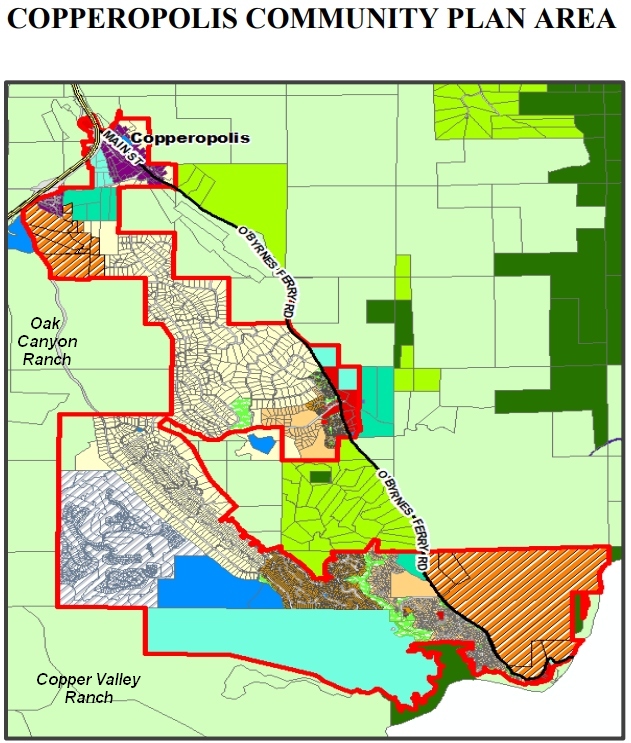
Attachment 2: BOS Ariola Agenda Submittal 23 GPA_Dec 4_Snapshot-19475
Attachment 3: Copper Valley Ranch Parcel Map appr_PC_080306m
Attachment 4: DEED 2020-000515-1 CA Rangeland Trust_Airola
Attachment 5: PC Resolution 2018-060 Oak Canyon Ranch_Attachment-7013
CPC Comments on Calaveras Evacuation and Access Needs Assessment and Preparedness Plan
CPC Comments on GHG Reduction Plan
Copperopolis Community Plan Comments
June 2023
CPC Member Ralph Copeland Comments on Copperopolis Community Plan
CPC Member Janet Sterling Comments on Copperopolis Community Plan
CPC Member Muriel Zeller Comments on Copperopolis Community Plan
CPC Comments on Copperopolis Community Plan
March 2023
MVS.com comments on Flint Trail MND
Attachments:
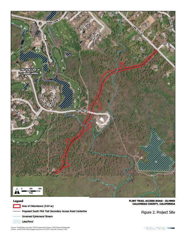
- Flint Trail Access Road MND Figure 2 Project Site Map_Pg. 16
- FlintTrail Access Road location_CCWD-Tuscany Hills Parcels
- item-7c-cv-holdings-subdivision-2_09_14_20
- Page 51 Map_CCWD 3-10-2021-Agenda-Package_surplus parcel-road to Tuscany Hills
- Tuscany Hills Phase I Final Map Sept 2019_BOS 03_10_20 Attachment-9472
January 2023
2023 GPU Implementation letter to Director
December 2022
Thoughts on Rural Clustered Development
November 2022
Letter to Planning Commission re:GHG Reduction Measures
Letter to County re: Conservation Education in Greenhouse Gas Reduction Plan
October 2022
Email to Director Elliot re:General Plan
CPC Comments on Economic Development
CPC Comments on Oak Woodland Ordinance
May 2022
CPC Facilitator Comments on Greenhouse Gas Inventory and Reduction Plan
Attachment 1 – Attachment 2 – Attachment 3 – Attachment 4
CPC Member Comments on Greenhouse Gas Inventory and Reduction Plan
April 2022
CPC Facilitator Comments on Greenhouse Gas Inventory and Reduction Plan
CPC Member Comments on Greenhouse Gas Inventory and Reduction Plan
February 2022
CPC Comments on General Plan Update Implementation Priorities
November 2021
CPC Comments on Draft Climate Adaptation Strategy
September 2021
August 2021
Project Consistency with Valley Springs Community Plan – MyValleySprings.com
June 2021
It is time to try something new when it comes to implementing plans in Calaveras County
May 2021
Empty Promises – a 13 year General Plan Process
Green House Gas Implementation in Calaveras County
April 2021
CCWD Must Be Transparent in the Sale of this Acreage
February 2021
Diverse Communities Deserve Their Own Plans
January 2021
- General Plan Implementation Work Program and Priorities
- Attachment 1 -List of Project Specific Evaluations
- Attachment 2 – GPU Implementation Plan from Sacramento
- Attachment 3 – GPU Implementation Plan from Amador County
- Attachment 4 – GPU Needs Implementation Staff
- Attachment 5 – CPC Press Release re GPU implementation hearing of 1-21-2.
- Attachment 6 – Flexible plan for 2019 General Plan Implementation
- Attachment 7 – Funding Programs for Implementing the General Plan Update.
- CPC Comments on the Proposed Zoning Map
- Open Space Zoning – Letter to BOS
July 2020
April 2020
- Letter of Support for Garamendi Conservation Easement
- Letter to BOS – Setting Priorities for Implementation of the General Plan
Related Documents for Reference
RESOURCE PRODUCTION LAND CONVERSION GUIDELINES
RESOURCE PRODUCTION LANDS MITIGATION PROGRAM GUIDELINES
CALIFORNIA SUSTAINABLE AGRICULTURAL LANDS CONSERVATION PROGRAM GUIDELINES FOR GRANT APPLICATION
Ecosystem Categories and Rangeland – UCANR
December 2019
- Notice to Agencies: Press Copy press copy notice to agencies
- Notice to Attorney General of Petition Filed Notice to AG
- Petition for Writ of Mandate https://calaverascap.com/12-8-19-petition-for-gpu-writ-of-mandate/
- Final Memos Sent to BoS November 2019 https://calaverascap.com/final-memos-sent-to-board-of-supervisors/
November 2019
- Opinion: The Valley Springs Community Plan Redux https://calaverascap.com/opinion-the-valley-springs-community-plan-redux/
- Opinion: The General Plan Update Is Over, Hypothetically https://calaverascap.com/opinion-the-general-plan-update-is-over-hypothetically/
August 2019
- Letter to the Editor: Valley Springs Deserves Better https://calaverascap.com/letter-to-the-editor-valley-springs-deserves-better/
- Letter to the Editor: Elected representatives’ job is to represent wishes of constituents https://calaverascap.com/letter-to-the-editor-elected-representatives-job-is-to-represent-wishes-of-constituents/
- Valley Springs News : Lack of Responsiveness in General Plan Update Hearings https://calaverascap.com/valley-springs-news-lack-of-responsiveness-at-general-plan-update-hearings/
July 2019
- Video: CPC members speak up at GPU Hearing to defend Community Plans https://calaverascap.com/videocpc-members-speak-up-at-gpu-hearing-to-defend-community-plans/
- Board of Supervisors Completes General Plan Update Hearing: Prepares to Rescind Community Plans https://calaverascap.com/board-of-supervisors-completes-general-plan-update-hearing-prepares-to-rescind-community-plans/
- Public Record Request for the Mintier-Harnish General Plan draft https://calaverascap.com/public-record-request-for-the-mintier-harnish-general-plan-draft/
June 2019
- Video : Why Retain Our Community Plans https://calaverascap.com/keep-our-community-plans-video-from-june-22-2019/
- Calaveras Enterprise : Planning Commission Approves General Plan Update, Eliminates Community Plans https://calaverascap.com/planning-commission-approves-general-plan-update-eliminates-community-plans/
- Spring/Summer 2019: Important Planning Commission Hearing Documents https://calaverascap.com/important-planning-commission-hearing-documents/
April 2019
- BREAKING! Coalition urges Supervisors to include Community Plans in General Plan Update https://calaverascap.com/breaking-coalition-urges-supervisors-to-include-community-plans-in-general-plan-update/
- General Plan Final EIR Released https://calaverascap.com/general-plan-final-eir-released/
- 2019 General Plan Comprehensive Guide https://calaverascap.com/2019-general-plan-comprehensive-guide/
January 2019
- Video: CPC urges County to adopt a legally defensible General Plan https://calaverascap.com/video-cpc-urges-county-to-adopt-a-legally-defensible-general-plan/
- Memo delivered to Board of Supervisors on GPU and DEIR fixes https://calaverascap.com/memo-delivered-to-board-of-supervisors-on-gpu-and-deir-fixes-on-january-22/
August 2018
July 2018
- Calaveras Enterprise “My Turn” : PG&E seeks agreement for the new safety program PG&E My Turn in CE
June 2018
- Email to Planning Commission re: Saddle Creek Development Agreement Extension To_PC_by_email_on_Saddle_Creek_DA_fin
March 2018
- Comments on Mokelumne River Draft Wild and Scenic River Study Report Final letter on Moke to Wall 3-1-18
October 2017
- Eleventh Hour consideration of Medical Cannabis Cultivation and Commerce Ordinance Project. A review and opinion letter of a report submitted to Board of Supervisors by County Supervisor Dennis Mills. By CAP’s Muriel Zeller –
- The Draft 2017 RTP provisions represent good steps to improve safety, aid the economy, and protect the environment. We strongly encourage Calaveras County to achieve consistency with the 2017 Draft RTP by including similar policies and implementation measures in its Circulation Element. The County must be an active partner in these endeavors if people are to reap the benefits of these particular 2017 Draft RTP policies. In addition, if the County adopted such implementation measures with sufficient commitment to achieve measurable standards, then the County could mitigate impacts of development under the Draft General Plan.
- Below is the CPC comments on the Draft 2017 RTP:
2017 RTP Letter from CPC_final
June 2017
Press Release” CPC Releases comments on Medical Cannabis Cultivation and Commerce Ordinance DEIR: Press release for Commercial Cannabis Cultivation June 2017 (1)
Planning Coalition Releases Comments on the Medical Cannabis Cultivation and Commerce Ordinance DEIR: 0 CPC – Cannabis DEIR Comments Combined in pdf
February 2017
Scoping Comments in response to the Notice of Preparation for the Calaveras County General Plan Update Environmental Impact Report:
4 Table of Contents & List of Contributors
9 Land Use and Plannind Scoping Comment
12 Traffic and Circulation scoping comments
Docume14 Guide to Attachments to assist the County in evaluating and mitigating the impacts of the General Plan Update:
AGRICULTURE:
2014_0225_marin-county-agricultural-land-conservation-program_final
Calaveras Draft Ag element October 2008
F.C. Ag preservation principles
farmlenad protection toolbox_02-2008
Monterey Agriculture Element Placer CGPPart5 Sacramento Agricultural-Element
Napa Ag Land Use Element 06-04-08
Sacramento Agricultural-Element
AIR QUALITY:
Air_Quality_-_Land_Use_handbook
BIOLOGICAL RESOURCES:
Cal_Wildlife_Action_Plan_final
GP_Bio_resources_goals_and_policies_FC
CHILD CARE FACILITIES:
including_child_care_in_local_planning
CONSERVATION AND OPEN SPACE:
Mono_ConservationOpenSpaceElement
DATA ANALYSIS:
ECONOMIC DEVELOPMENT:
InvestingforProsperity Workforce_Development_Piece_FINAL_10-08-03
Workforce_Development_Piece_FINAL_10-08-03
FIRE HAZARD PLANNING:
Fire_Hazard_Planning-Final_Report
GENERAL PLAN GUIDELINES:
DRAFT_General_Plan_Guidelines_for_public_comment_2015(2)
GLOBAL CLIMATE CHANGE:
CAPCOA_White_Paper_Climate_Change
Global_Warming_mitigation_measures
HISTORIC PRESERVATION:
LAND USE:
Calaveras Cannabis Cultivation EIS_2017
General Plan Update Community Planning Element Valley Springs Community Plan 1-26-17
PUBLIC SERVICES:
adoptedcalaveras_fire_msr_final_no_mhfpd_downsized
final_calaveras_water_wastewater_msr_2012
jbfinal_csd__csa_report_adopted_copy
TRAFFIC:
493_FinalRTP_2012CalaverasRTP_wExecAppend(2)
494_2012-Calaveras-County-RTP_PublicReviewDraft_Released-July-27-2012
BIKE TRAILS:
Amador Bike Survey Implications
Calaveras County Baseline Report Omissions
Response to Draft General Plan Baseline
WATER PLANNING:
LGC_Water_Planning_Ch_3_Sect_3_4
December 2016
8-17-16 letter to pc in pdf final8-31-16
Letter to Cal. PC re Copperopolis
October 2016
CPC Comments for BOS re. General Plan Draft & Map, BOS meeting 10/4/16:
Joyce Techel speaking on behalf of MyValleySprings.com & the Calaveras Planning Coalition:
September 2016
Calaveras Planning Coalition Position Paper – September 2016: (AN EIR IS NEEDED ON COMMERCIAL CANNABIS CULTIVATION AND ASSOCIATED ACTIVITIES)
an-eir-is-needed-on-commercial-cannabis-cpc-position
August 2015
General Plan Update:
Asphalt Plant Update:
- Letter to BOS Re Asphalt Appeal 2-8-16
- Testimony of Thomas P Infusino v2
- Valley Springs advocacy group submits asphalt plant issues to county
- Full impact of asphalt plant to be examined
- Asphalt plant fact and speculation
- CPC Letter re Asphalt Plant Appeal (00000002)
- Hot plant fact sheet misleading
June 2015
Good Planning can enhance Property Rights, Property Values & Property Interests – Presented by Tom Infusino on June 8, 2015 at CPC’s Let’s Talk About: How good planning protects property rights and how planning for economic development increases local self-sufficiency and quality of life.
Good Planning can enhance Property Rights posting
Tell the Board of Supervisors what you want in the General Plan
Last year Calaveras County released the text of the Draft General Plan for public comment. That text did not include the Community Plans. That text did not include the vision and principles developed in 2008 after two years of public workshops. The CPC drafted and distributed a petition for the Earth Day Celebration in 2015.
June 2014
Muriel Zeller – Calaveras Enterprise Columnist
Take a Lode off:
June 2014
- Items for discussion at Planning Commission on 6-12-14,
including the Saddle Creek Development Agreement Extension:
- To PC by email on Saddle Creek DA fin
- From Colleen June 26 Planning Commission:
(Ward has video posted on CAP: https://calaverascap.com/june-26-2014-calaveras-county-planning-commission/)1) At first Public Comment, I followed up on Tom’s presentation at 6/12 meeting. I thanked the commissioners for being receptive to his suggestions for mitigation and development project monitoring and establishing protocols for review of old environmental docs for extensions, and for requesting future study sessions.2) At second Public Comment, I thanked them for bringing up their desire to address the problem of residential outdoor lighting, which is not addressed in code and has come before them over and over for 5+ years, has been dealt with inconsistently, and I suggested they include language in the GPU to address and bring back in SS.3) Peter Maurer’s then made a report/ comments which are worth listening to. He seemed receptive to this idea of language in the GPU (and other ideas), and to having a study session late July or August as an annual planning project update along with addressing suggestions from Mr. Infusino. He also talked about trying to get history/background of GPU, meeting with interest groups, “working in a vacuum”, “no continuity of staff”, “bookshelves of documents” but “what’s pertinent today?” It’s worth listening to for a few minutes to get a sense of where the Director is coming from.4) Autozone filed an appeal to the BOS yesterday. They are also requesting modification of the road standards. PC Karen Sisk said “I can see problems developing there” (which I asked about afterwards and she doesn’t like the idea of a lot of access driveways and congestion in that area).
April 2014
- Written comments to DWR on the MAC IRWMP Update (April 18, 2014)
March 2014
Articles of Interest:
CAP and CPC member Bob Dean talks about Water and Land Use in an article for the Calaveras Enterprise:
- WATER AND LAND USE – Part 1
CPC member and Foothill Conservancy Executive Director Cecily Smith writes about the historic Calaveras Supervisors vote for Mokelumne River Wild & Scenic Designation:
February 2014
Presentation to public by Tom Infusion at CAP/CPC public meeting Feb. 3, 2014:
Articles of interest to CAP/CPC:
- Community plans are of utmost importance_CE-Opinon_02_07_14 (A guest opinion to the Calaveras Enterprise by CAP and CPC member Mickey Williamson
- Planners tea party find selves on common ground_SR_02_04_14
January 2014
Articles of interest to CAP/CPC:
CAP Governing Committee Co-chair and CPC member Joyce Techel letter to the Calaveras Enterprise:
Planning Updates for 2013
October 2013
Planning Updates
- Please amend the IRWMP Draft Plan Review Procedures (DPRPs)
2. Testimony of Tom Infusino, On behalf of the Calaveras Planning Coalition,
At the EBMUD Hearing in San Andreas, CA, on October 21, 2013,
Regarding the Camanche Water Permit Deadline Extension Draft EIR
September 2013
Planning Updates
- General Plan Update
August 2013
Planning Updates
- General Plan Update
- CPC’s response to the General Plan Update notice to submit policy suggestions:
- Cover for GPU Comments
- Section 1 Topics List Previously Generated
- Section 2 Integrate CEQA and Project Review
- Section 3 Earth club GPT Input
- Section 4 Community Plans
- Section 5 Policies from Optional Elements
June 2013
Planning Updates
- General Plan Update
May 2013
Planning Updates
- General Plan Update
April 2013
Planning Updates
- General Plan Update
- Letter to Calaveras Planning regarding:
- GPU Scoping before Policies
March 2013
Planning Updates
- General Plan Update
- Economic Development Workshop Comments 3-26-13 old word
- CPC General Comments on Draft Map 2: CPC General Comments on Draft MAP 2.”
- CPC Comments on the Preliminary Setting Sections of the General Plan Update EIR.
Download Here: Draft Setting
February 2013
Planning Updates
- General Plan Update
- Re: Comments on Sawmill Project:
- Testimony of Thomas P. Infusino, Calaveras Planning Coalition: To Calaveras County Board of Supervisors, 2-26-13:Download Here: to BOS on Sawmill 2-26-13 2 final
January 2013
Planning Updates
- RE: The Calaveras Planning Coalition recommends continuing to improve the MAC IRWMP over the next two years:
- Read Tom Infusino’s letter to UMRWA Board of Directors: Letter to UMRWA on MAC IRWMP
- RE: The CPC Appreciates that the MAC IRWMP is Item 11 on the Calaveras Board of Supervisors Consent Agenda: The CPC Appreciates that the MAC IRWMP is Item 11 on the Consent Agenda
December 2012
October 2012
- Draft MAC IRWMP. (Mokelumne-Amador-Calaveras (MAC) Regional Water Management Plan Update)
September 2012
Planning Updates
- RE: Agreement with Staff Report Recommendations for the Sawmill Project on your Agenda for 9-13-12. Download here: Sawmill to P C 9-12-12 fin
April 2011 through April 2012
- 2011 TALK2 fin
- Amador GP comments June of 11.fin
- BOS email CSC
- Comments on UWMP June 6
- CPC on UWMP Final
- EBMUD Hearing 1-11-12
- EBMUD Scoping Testimony 7-14-11
- Exhaustion of Remedies (2)v fin
- Parable of the King 7-14-11
- Shooting Range Finding Add-ons_CP fin
- Testimony Before the Calaveras County Board of Supervisors on 11
- Testimony of Tom Infusino 3-13-12
Comment Letters
- In Support of Agriculture & Forestry Elements (by Muriel Zeller, 01/20/09)
- Calaveras Planning Coalition comments on Draft Water Element (01/15/09)
- Bear Valley DEIR Letter (11/04/08)
- Wallace Lake Estates Project (05/16/07)
- Crestview Estates Project (05/16/07)
- North Vista Plaza (04/28/07)
Testimony at County Hearings & Meetings
- Comments to Planning Director on Draft Economic Analysis (11/14/08)
- Comments to Board of Supervisors on Issues & Opportunity Report (08/05/08)
- Comments to Board of Supervisors on General Plan Water Element (08/05/08
- Comments to Board of Supervisors on the Extension of the Urgency Ordinance (11/23/07)
- Comments to Board of Supervisors & Planning on General Plan Update Process (04/28/07)
- Testimony on the need for Community Plan updates (08/21/07)
- Presentation at Board of Supervisors Study Session about General Plan Update by Tom Infusino (01/23/06)
- Testimony to Board of Supervisors about Blue Mountain Residential Center by Tom Infusino (10/16/06)
Op-Ed Pieces
- At the Crossroads Op-Ed by Ward La Valley
- Where Are We in the County General Plan & Community Plan Updates? A presentation to the Chamber of Commerce Panel by Tom Infusino (09/11/07)
- The Real Planning Coalition A guest opinion by Tom Infusino in response to Tom Tryon (08/31/07)
- Calaveras Needs Economic Vision Op-Ed by Steve Elias Calaveras Enterprise (11/23/07)
- The Cost of Rural Residential Development By Mickey Williamson for the Calaveras Planning Coalition(08/31/07)
- What is the Environment and Why do we Need a Report on it? By Muriel Zeller or the Calaveras Planning Coalition (05-30-07)


