project focused on sustainable land use planning.
Find out more about us >>
Ranchers Vow Showdown on Wagon Trail
Alex George | Posted: Tuesday, February 14, 2012 9:31 am
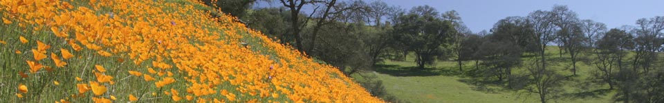
Drive west on Highway 4, a couple of miles past Angels Camp, and you pass ranches that predate Mark Twain, harkening back to when the only roads were wagon trails. Clenching the steering wheel tight, pumping the brakes, you wind through sharp bends on your way to Copperopolis. If you get going too fast down a hill, a 25 mph curve corrals you back to the brake pedal.
The scene is nondescript, one of Calaveras County’s many bucolic stretches surrounded by bull pines and livestock. However, debate over how best to straighten this portion of Highway 4, known as the Wagon Trail Project, has created a major rift between nearby property owners and county officials, most notably Supervisor Tom Tryon.
At a Jan. 24 Board of Supervisors meeting, supervisors voted 4-0, with one abstention, to authorize the Public Works Department and the Calaveras Council of Governments (CCOG) to administer the Wagon Trail’s environmental documentation at an estimated cost of $1,495,258. The environmental process will examine a northern and southern alignment to determine which road can be completed at a lower cost. Officials will measure cuts needed through hills and fills at drops in the right of way. However, the documentation process does not analyze the affects the road would have on grazing land, in some cases splitting valuable flat lands in half.
Bill Spence and Walt Valente, two patriarchs whose families have owned land in Calaveras for generations, are opposing the northern alignment, a route they say will cost more, be longer in distance and divide ranch lands into virtually unusable parcels.
“As far as this Wagon Trail thing, it’s about the rottenest situation of anything I’ve been involved in a long time,” said Spence, whose ranch sits on the land in question. “It started out fairly clean. We had a meeting, and at that meeting they told us there were 13 property owners. The 13 owners halfway agreed on where the design should go and that is unbelievable. When do you get 13 property owners to agree on anything let alone where a new road should be built?”
“We went to work, myself, my sister and all the impacted property owners,” Valente said, “We developed an alignment, talked to major property owners, and we had a concurrence of that alignment.”
Spence, Valente, and John Tiscornia, who owns an estimated 85 percent of ranch land on the current road, have banded together to support the southern alignment, or “blue alignment.” According to the ranchers, the blue alignment will preserve the continuity of farm land, protect open space for wildlife migration, and leave Miwok cultural sites, such as the American Indian graveyard, undisturbed, they said. But could two roads so similar in length and proximity really be that different?
“They are a lot different,” Valente said. “The one we’re advocating is about one mile less construction or more. We measured it and we itemized all the problems. There is really no other need for this northern alignment. Our alignment has fewer bridges and has culverts in it. Our alignment is the shortest one, and has less negative impact for the group of property owners. That’s all you’re looking for. You want to have two main criteria, safety and capacity, and our alignment does that.”
A vocal opponent of the southern alignment, county Supervisor and CCOG board member Tom Tryon insists the northern alignment will better maintain the integrity of the current road.
“I would like to have an alignment that would preserve the integrity of the old road,” Tryon said. “The current road would work well as a bicycle and pedestrian path from Angels to Copperopolis. But the property owners do not agree, they would like to do away with the present road. I am not an advocate of that.”
Spence, his sister Barbara Burger, Valente, and sister Anita Valente Nyland uniformly believe that Tryon is motivated by self-interest. Tryon operates a bed and breakfast on his own ranch, eight miles northeast of the proposed Wagon Trail and on the east side of Highway 49, and some ranchers think his advocating for the northern alignment is directly tied with his desire to have a bike path connecting Angels Camp to Copperopolis – a proposal ranchers say will drive more tourists to Tryon’s B&B.
“Tom Tryon told us emphatically right to our faces, to John (Tiscornia), and the Spences that we didn’t have a damn thing to say about it,” Valente said. “It was him and him only because he was our elected official and that’s it. You talk about polarizing the whole county, they (Tiscornias) won’t even talk to him. I’m his neighbor, but to come up against us and to tell us we don’t exist and we don’t know what the hell we are talking about is just not right.”
“There have been a lot of things that have seemed to go on that smell,” Valente’s sister Anita said. “Everything from the beginning of the Wagon Trail project, people hired and fired, have all been manipulated by Tom Tryon. He wants that horse trail business. He even said that at a CCOG meeting that he would like to see the current road turned into a horse trail.”
The CCOG meeting Anita is referring to took place March 25, 2010, at Bret Harte High School. However, Anita said the March meeting was not the first time Tryon expressed his preferred alignment, where he explicitly referenced the benefits of building a pedestrian path.
“This would be a perfect equestrian connector between the fairgrounds and Copperopolis,” Tryon said at the first Wagon Trail meeting Feb. 9, 2009. “It would allow riders a good loop.”
“Why would Tryon care what the alignment is if it provides a good road for the traveling public?” Burger asked.
While Tryon told the Enterprise he would like the current road transformed to a pedestrian and bike path, he refutes accusations that his motivation is somehow self-serving.
“My property is on the other side of town,” Tryon said. “Some people think everything that comes in front of the board I have a conflict with. They’re convinced a horrible corruption, or conspiracy and injustice is happening and, my God, they’re gonna clean it up.”
Tryon’s comments come on the heels of the board’s last meeting, where Calaveras resident George Fry accused Tryon of being a puppeteer, pulling the strings of fellow Supervisor and CCOG member Gary Tofanelli and CCOG Executive Director Melissa Eads.
Although Tofanelli and Eads have not walked the alignments, despite invitations from Valente, both say they are committed to working with property owners to develop an alignment that would address safety and capacity needs.
“You know I’m supposed to meet with Walt Valente and go over the property,” Tofanelli said. “I think this is another situation where property owners themselves need to have some input. We need to hear them out, and we need to listen to what they have to say. I’m not a builder of highways, I’m not an alignment specialist, and I’m not a surveyor, but I will have a role in deciding a vote at the county level. … I have always been in favor of the property owners so I want to see first-hand what the best alignment is.”
Eads has not yet walked the property-owners supported alignment, but said she welcomes the opportunity to meet with property owners in an effort to build trust.
“I think our goal is to secure right of entry through the environmental studies,” Eads said. “And so we look forward to continuing the public outreach process to build relationships with the property owners. But in the event that’s not successful, we’re working with Caltrans to develop an alternative methodology that Caltrans and the public agencies can be comfortable with in completion of our documentation.”
In other words, if an agreement between local agencies and property owners is not reached, California statute allows for the state to seize the property without the owners’ consent – an action known as eminent domain.
Some property owners, such as Burger herself, said she would not sell the homestead purchased by her great-grandfather.
“I am holding on to this land and doing the best I can for this land,” Burger said. “This land is a treasure to us and we have taken care of it. We know this road has to be built, but we want it done on our preferred alignment.”
Both Spence and Walt Valente, who also serves as a member on the CCOG, said property owners recognize the need for a new road, but will not support the northern alignment, especially if the current road is turned into a pedestrian path.
“The current road for the most part is called a prescriptive rights road,” Spence said. “In other words we own the property and we pay taxes on the property. We’ve been here since 1852. If they try to build a horse trail on that road we will just shut the road down. Tiscornia, who owns most of that property, said he would just shut it down.”
Contact Alex George at ageorge@calaverasenterprise.com
Read the original article here.