project focused on sustainable land use planning.
Find out more about us >>

County Improves Accessibility of Zoning Update Map after encouragement from MVS.com
As Calaveras County planning staff move forward with the Zoning Update, regional groups have been diligent in their participation throughout the process. Recently MyValleySprings.com (MVS) seems to have made some headway with the County after multiple requests for improvements to be made to the GIS Map and related zoning update information.
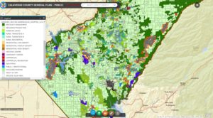
The original view showed only land use designations – it was not easy to figure out how to make the map show the relevant information about proposed zoning changes.
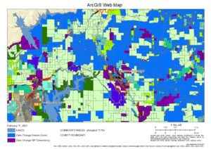
The default view now shows parcels with zoning changes in blue
On January 22nd: “MVS submitted more comments about the zoning map (directly to Planning) about the many problems with public access, use, and understanding of the proposed zoning map and zoning information. We also noted some errors and suggested some changes. The attached new Zoning Map Help file was created by Peter Maurer on Feb. 3 and posted on the Planning page.”
As well as providing a useful Help file, the County changed the default map view to show the proposed zoning changes layers instead of the land use layer.